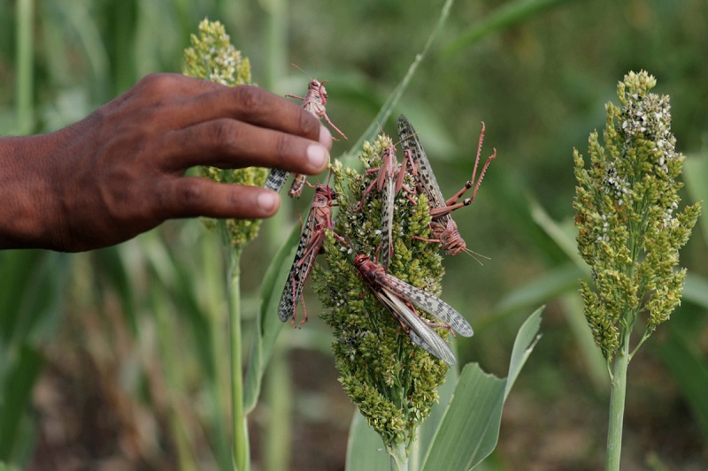
The Eastern Cape of South Africa experienced the worst locust infestation in 25 years in May 2022, destroying 19,305 square kilometres of grazing area. Farmers in the enormous 65,238-square-mile province have teamed up with scientists to introduce a high-tech innovation—a software package to track locust swarms in real-time in the hopes of targeting them for extermination before they cause significant damage—with another swarm predicted for September (the start of spring in the Southern Hemisphere).
Bruce Jones, the country representative for EarthRanger, a software product of the nonprofit Allen Institute for Artificial Intelligence, will be the first time the state-of-the-art program is used to track locusts in South Africa. In order to produce real-time wildlife and pest reports covering large areas of land, the software solution was created by Vulcan Incorporated in collaboration with a number of conservation and technology partners. It combines real-time data from ranger patrols, remote imaging, and various sensors.
In the past, South Africa had solely utilised this tracking technology to keep an eye on the movements of major game species. After 113 elephants perished over the course of two years at the hands of poachers in the nation’s largest nature reserve, the 7,523-square-mile Kruger National Park, it was introduced there in 2017.
Related Posts
In East Africa, where the insects swarmed at record levels in Ethiopia, Somalia, Kenya, Uganda, South Sudan, and Tanzania in 2019 before going extinct in 2021 after being targeted by those nations, Jones pointed out that the locust tracking device is widely employed.
Together with the Food and Agriculture Organization of the United Nations (FAO), EarthRanger has run command centres in Kenya and Ethiopia to follow the movements of locust swarms and to organize the quick deployment of personnel and aircraft to eradicate swarms.
The manager of the agricultural association for the Eastern Cape (AgriEC), Gunther Pretorius, claims that before the association and the province’s agriculture department invested in EarthRanger’s assistance, they could only locate a locust swarm if a farmer or member of the public telephoned their offices with the information. Such calls made it very challenging to properly locate the swarms because they frequently lacked GPS coordinates.
Now that GPS pins can be sent by farmers, Pretorius explained, “we can enter this data into EarthRanger and see exactly where these locusts are, and whether they are at hopper stage [young locusts that can’t yet get aloft] or already flyers.” Our district locust officers will find it quite simple to decide where to spray, which swarms are the largest, and which swarms to spray first thanks to this.
The software relies on local users to supply it with data through reports to the AgriEC headquarters. Although the technology is capable of connecting to drones that could gather additional data over a larger region, that interface has not yet been established in the Eastern Cape.
However, Pretorius is convinced that the software’s maps of locust activity will significantly aid farmers and the government in eradicating infestations this September.