Last updated on September 11th, 2021 at 07:55 am
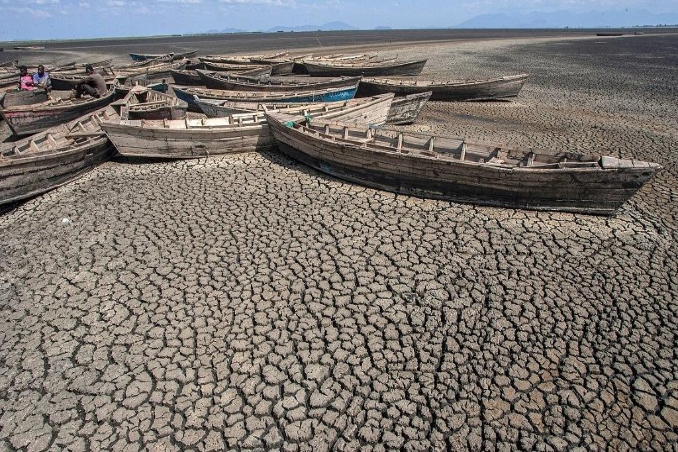
The Intergovernmental Panel on Climate Change (IPCC) issued a warning on Monday, saying that greenhouse gas levels in the atmosphere are already high enough to cause climate change for decades, if not millennia. Lake Chilwa, Malawi’s second-largest lake, is already suffering as a result of this.
Thousands of Malawians rely on Lake Chilwa, the country’s second-largest lake, for their livelihood. Climate change has brought “extremity in weather,” according to Professor Sosten Chiotha, Regional Director of Leadership for Environment and Development (LEAD), resulting in less rainfall and abnormally low water levels in the lake.
“Water variations are normal, but the connection with climate change is that the factors that drive the drying are actually periods of low rainfall,” says Professor Sosten Chiotha. “In our project, the Lake Chilwa Climate Change Adaptation project, we actually elaborated that if you have three consecutive rainy seasons with rainfall below 1,000mm, then the lake is likely to dry.”
According to published literature, it was a 20 to 25-year cycle. Since the 1990s, the frequency of dryness has risen, which is linked to the effects of extreme weather events that are characteristic of climate change.
“Climate change has brought more extremes in weather, so we are having more dry spells, which is why the lake appears to be drying more frequently than it used to, so the current drying is not normal.” “The current fluctuations in water levels are not normal, and that is because of the extremes in rainfall,” says one-and-a-half million people who live in the Lake Chilwa Basin.
Related Posts
The Intergovernmental Panel on Climate Change (IPCC) report, which made headlines on Monday, is the most thorough examination of climate science ever conducted, expanding our understanding of how and how quickly greenhouse gas emissions are altering the globe.
Experts warn, however, that the comprehensive global evaluation contains blind spots, such as locations that are particularly sensitive to climate change consequences yet lack data on those impacts.
The IPCC offers three maps of the planet, each divided into hexagons, in its 40-page Summary for Policymakers. Each map depicts changes in high heat, rainfall, and drought that have been documented.
While extreme heat is becoming more common almost everywhere, when it comes to rainfall and drought, South America, Africa, and the Pacific Island states, in particular, are virtually blank slates.

